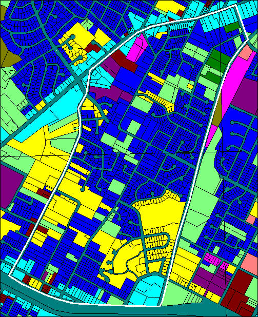
South Lamar Neighborhood Association Landuse Map
Downloaded from Austin September 2000
Copied verbatim from the City of Austin GIS Data Sets:
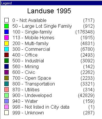
LU95 - Landuse Code 1995
|
0 |
Error or out of Study Area |
|
50 |
Large Lot Single Family |
|
100 |
Single-family |
|
113 |
Mobile Homes |
|
200 |
Multi-family |
|
300 |
Commercial |
|
400 |
Office |
|
500 |
Industrial |
|
560 |
Mining |
|
600 |
Civic |
|
700 |
Open Space |
|
800 |
Transportation |
|
870 |
Utilities |
|
900 |
Undeveloped |
|
940 |
Water |
|
999 |
Unknown |
EXCODE - Exempt code if property is tax exempt
|
0 |
Not Available |
|
1 |
Streets |
|
11 |
Federal |
|
12 |
State |
|
13 |
County |
|
14 |
Municipal |
|
15 |
School District |
|
16 |
Colleges |
|
17 |
Redevelopment Agencies |
|
18 |
Churches |
|
19 |
Miscellaneous |
|
20 |
Private |